Just as the settlements around the Ancient Mediterranean would seem disconnected without the sea to join them, so online ancient world resources have been separated, until now. Meaning “of the sea”, Pelagios has brought this world together using the principles of Linked Open Geodata. The Pelagios Graph Explorer allows students, researchers and the general public to discover the cities of antiquity and explore the rich interconnections between them.
The Pelagios Graph Explorer
Alice is an archaeology student from Memphis, TN. When not collecting Elvis singles, she loves nothing better than to find out about cities of the past. Recently she has come across Arachne, the database of images and finds from the German Archaeological Institute. She's interested in her hometown's namesake, Memphis, Egypt, and so she types it into the search box (fortunately it's the same word in German) and finds quite a few interesting results: 21 objects and 16 sets of photos. But what do they mean? What stories do they tell? And what role did Memphis play in the ancient world? What Alice doesn't know is that there are many other open resources out there with information about Memphis, its history and material culture and has no way to find out.
Enter the Pelagios Graph Explorer. Using the principles of Linked Open Data, the Pelagios Explorer allows people like Alice to discover those resources (including Arachne). When she types 'Memphis' into the Explorer's search box she is presented with a graph of information that shows her a range of different resources that relate to the city. Hovering the mouse over the pink circle, a balloon pops up about the Perseus Digital Library which seems to have 13 separate references to it. And clicking on a reference in the data view takes her straight there.

Now that's all well and good, but it rather begs the question: How would she find out about Pelagios in the first place? The answer is simple. As well as being a human interface, Pelagios is also an API, allowing resource curators to embed links right next to their own content. For instance, Carlo the classicist might be exploring the geographic flow of Herodotus's Histories using GapVis which has lots of handy info - a map, related sites, photos, etc. But the handy 'Pelagios Graph Explorer' link takes him straight to Pelagios and even fills in the details for him. This is the power of Linked Open Data - content providers such as Arachne can open up up a world of contextual information with a single link.

There's a lot more we could tell you about Pelagios - the fact that you can use the Explorer to find relationships between multiple cities for instance, or that it's an ever-growing collective of content providers committed to the principle of openness and public access. We could also tell you about the plans we have for Pelagios2 - to refine the data, improve the search facilities, and expand the community. But we think the best way to explore it is to have a go yourself. So why not check out our user guides and dive in!
Who are Pelagios?
Pelagios is a collective of projects connected by a shared vision of a world - most eloquently described in Tom Elliott’s article ‘Digital Geography and Classics’ - in which the geography of the past is every bit as interconnected, interactive and interesting as the present. Each project represents a different perspective on Antiquity, whether map, text or archaeological record, but as a group we believe passionately that the combination of all of our contributions is enormously more valuable than the sum of its parts. We are committed to open access and a pragmatic lightweight approach that encourages and enables others to join us in putting the Ancient World online. Pelagios is just the first step in a longer journey which will require many such initiatives, but we welcome anyone who shares our vision to join us in realising it.


Pelagios is a collective of projects connected by a shared vision of a world - most eloquently described in Tom Elliott’s article ‘Digital Geography and Classics’ - in which the geography of the past is every bit as interconnected, interactive and interesting as the present. Each project represents a different perspective on Antiquity, whether map, text or archaeological record, but as a group we believe passionately that the combination of all of our contributions is enormously more valuable than the sum of its parts. We are committed to open access and a pragmatic lightweight approach that encourages and enables others to join us in putting the Ancient World online. Pelagios is just the first step in a longer journey which will require many such initiatives, but we welcome anyone who shares our vision to join us in realising it.
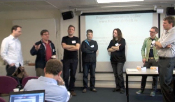 |
Members of the Pelagios Team at our February 2011 kick-off workshop. From left to right: Rainer Simon, Greg Crane, Mark Hedges, Reinhard Förtsch, Mathieu D’Aquin, Elton Barker and Sean Gillies. Missing from the photo are: Leif Isaksen, Sebastian Rahtz, Sebastian Heath, Neel Smith, Eric Kansa, Kate Byrne, Tom Elliott, Alex Dutton, Rasmus Krempel, Bridget Almas, Gabriel Bodard and Ethan Gruber
Pelagios was made possible by the following organizations:
|


TABLE OF CONTENTS
Project Plans
Budget
Project Progress
- Welcome
- The Workshop
- Arachne
- Arachne Update
- CLAROS
- Nomisma
- Nomisma Update
- Perseus
- The Ptolemy Machine
- SPQR
- Choosing an Ontology
- SPARQL Demo
- Tagging Places on Old Maps: The DME Scenario
- The PELAGIOS Graph Explorer: A First Look
- PELAGIOS Graph Explorer - The Live Demo
- (Re-)Using the Graph Explorer Pt. 1: Technology
- (Re-)Using the Graph Explorer Pt. 2: API
- (Re-)Using the Graph Explorer Pt. 3: Getting Your ...
- Pelagios usability testing results
- Evaluating usability: what happens in a user testi...
- Evaluating Pelagios' usability
- The *Child of 10* standard
No comments:
Post a Comment